File:Simmering (Wien) - Gasometer (1).JPG
Size of this preview: 800 × 566 pixels. Other resolutions: 320 × 226 pixels | 640 × 453 pixels | 1,024 × 724 pixels | 1,280 × 905 pixels | 2,560 × 1,811 pixels | 3,624 × 2,563 pixels.
Original file (3,624 × 2,563 pixels, file size: 9.63 MB, MIME type: image/jpeg)
Summary
| Description |
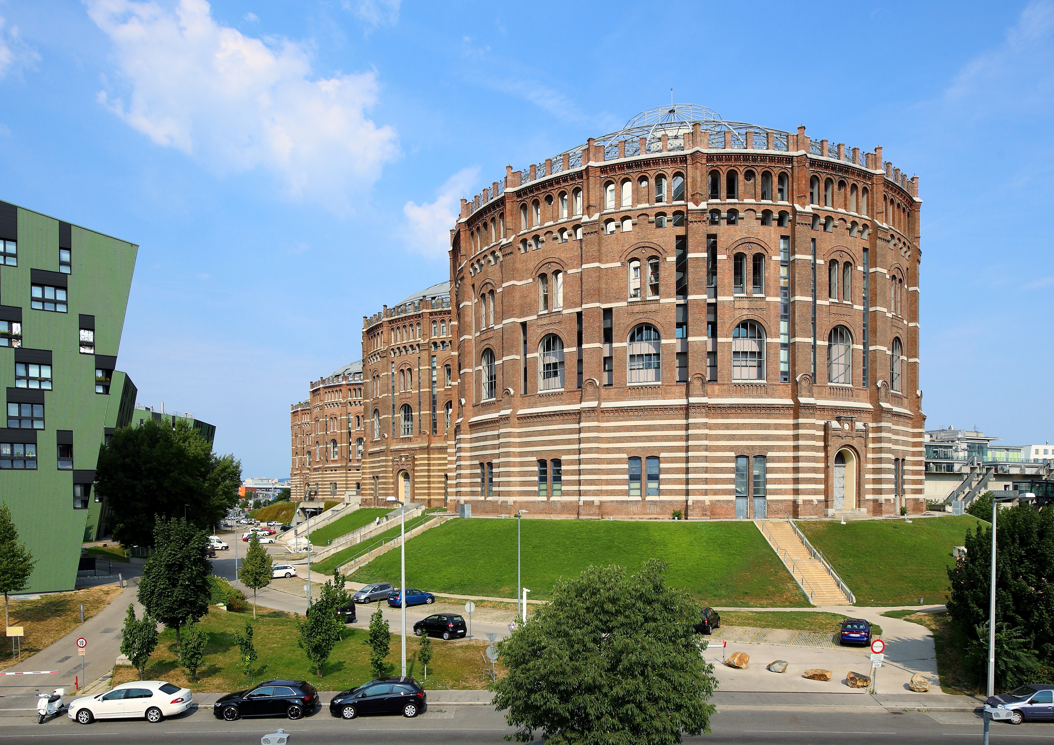
Deutsch: Südostansicht der 4 Gasometer im 11. Wiener Gemeindebezirk Simmering.
Die 4 Gasometer mit jeweils einem Innendurchmesser von rund 63 Meter, einer Höhe von 75 Meter und einem Fassungsvolumen von 90.000 m³ Gas wurden von 1896 bis 1899 im Zuge der Errichtung des städtischen Gaswerkes Simmering gebaut. Um 1980 wurden sie als späthistoristische Industriedenkmale unter Denkmalschutz gestellt und Mitte der 1980er Jahre stillgelegt. Von 1999 bis 2001 erfolgte ein Umbau zu einem Wohn-, Geschäfts- und Einkaufszentrum, wobei nur die äußeren Sichtziegelmauerwerke mit den Dächern erhalten blieben. |
| Date | |
| Source | Own work |
| Author | C.Stadler/Bwag |
| Permission (Reusing this file) |
Deutsch: Hallo, du darfst meine Fotos kostenlos nutzen, aber nenne mich bitte als Fotograf, beispielsweise „Foto: C.Stadler/Bwag“ oder © C.Stadler/Bwag; CC-BY-SA-4.0. Auf mehr Angaben bestehe ich nicht - im Gegensatz zu manch anderen, die die Vorgaben der unten angeführten Lizenzierung auf Punkt und Beistrich einfordern. English: Feel free to use my photos, but please mention me as the author like © C.Stadler/Bwag or © C.Stadler/Bwag; CC-BY-SA-4.0 (that's good enough) and if you want send me a message: bwag@gmx.net. |
| Other versions |
|
_-_Gasometer_(2).JPG)
_-_Gasometer_(1).JPG)
| Object location | | View this and other nearby images on: OpenStreetMap |
|---|
_-_Gasometer_(1).JPG¶ms=048.184890_N_0016.419970_E_globe:Earth_class:object_type:object_region:AT-9_&language=en)
| Camera location | | View this and other nearby images on: OpenStreetMap |
|---|
_-_Gasometer_(1).JPG¶ms=048.183950_N_0016.422397_E_globe:Earth_type:camera_alt:190.2_source:exif_&language=en)
Licensing
I, the copyright holder of this work, hereby publish it under the following license:
This file is licensed under the Creative Commons Attribution-Share Alike 4.0 International license.
- You are free:
- to share – to copy, distribute and transmit the work
- to remix – to adapt the work
- Under the following conditions:
- attribution – You must give appropriate credit, provide a link to the license, and indicate if changes were made. You may do so in any reasonable manner, but not in any way that suggests the licensor endorses you or your use.
- share alike – If you remix, transform, or build upon the material, you must distribute your contributions under the same or compatible license as the original.

|
This image was uploaded as part of Wiki Loves Monuments 2015.
|
This image has been assessed using the Quality image guidelines and is considered a Quality image.
|
File history
Click on a date/time to view the file as it appeared at that time.
| Date/Time | Thumbnail | Dimensions | User | Comment | |
|---|---|---|---|---|---|
| current | 12:57, 2 September 2015 | | 3,624 × 2,563 (9.63 MB) | wikimediacommons>Bwag | {{Information |Description= {{de|1=Südostansicht der 4 Gasometer im 11. Wiener Gemeindebezirk Simmering.<br/>Die 4 Gasometer mit jeweils einem Innendurchmesser von rund 63 Meter, einer Höhe von... |
File usage
The following page uses this file:
_-_Gasometer_(1).JPG)