File:Wien - Stephansdom, Grabmal Kaiser Friedrichs III.JPG

Size of this preview: 800 × 533 pixels. Other resolutions: 320 × 213 pixels | 640 × 427 pixels | 1,024 × 683 pixels | 1,280 × 853 pixels | 2,560 × 1,707 pixels | 4,252 × 2,835 pixels.
Original file (4,252 × 2,835 pixels, file size: 10.94 MB, MIME type: image/jpeg)
Summary
| Description |
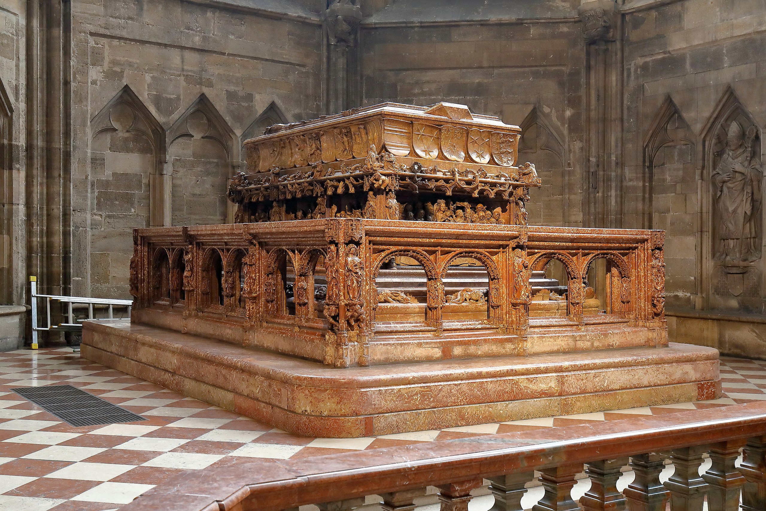
Deutsch: Das Grabmal Kaiser Friedrichs III. im Chor (Apostelchor) des rechten Seitenschiffes des Stephansdoms in der österreichischen Bundeshauptstadt Wien.
Das Grabmal für Kaiser Friedrich III. ist aus rotbraunem, geflecktem Adneter Marmor gefertigt und ist eines der größten Werke spätgotischer Skulptur. Die Deckplatte des Sarkophags schuf Niclas Gerhaert van Leyden zu Lebzeiten des Kaisers. Nach dessen Tod wurden die Arbeit von Max Valmet weitergeführt. Die Balustrade dürfte unter der Leitung von Michel Tichter hergestellt worden sein. Am 12. November 1513 wurden die Gebeine Friedrichs III. vom provisorischen Bestattungsort in der Herzogsgruft feierlich in den fertiggestellten Sarkophag übertragen. |
| Date | |
| Source | Own work |
| Author | C.Stadler/Bwag |
| Permission (Reusing this file) |
Deutsch: Hallo, du darfst meine Fotos kostenlos nutzen, aber nenne mich bitte als Fotograf, beispielsweise „Foto: C.Stadler/Bwag“ oder © C.Stadler/Bwag; CC-BY-SA-4.0. Auf mehr Angaben bestehe ich nicht - im Gegensatz zu manch anderen, die die Vorgaben der unten angeführten Lizenzierung auf Punkt und Beistrich einfordern. English: Feel free to use my photos, but please mention me as the author like © C.Stadler/Bwag or © C.Stadler/Bwag; CC-BY-SA-4.0 (that's good enough) and if you want send me a message: bwag@gmx.net. |
| Object location | | View this and other nearby images on: OpenStreetMap |
|---|
| Camera location | | View this and other nearby images on: OpenStreetMap |
|---|
Licensing
I, the copyright holder of this work, hereby publish it under the following license:
This file is licensed under the Creative Commons Attribution-Share Alike 4.0 International license.
- You are free:
- to share – to copy, distribute and transmit the work
- to remix – to adapt the work
- Under the following conditions:
- attribution – You must give appropriate credit, provide a link to the license, and indicate if changes were made. You may do so in any reasonable manner, but not in any way that suggests the licensor endorses you or your use.
- share alike – If you remix, transform, or build upon the material, you must distribute your contributions under the same or compatible license as the original.
File history
Click on a date/time to view the file as it appeared at that time.
| Date/Time | Thumbnail | Dimensions | User | Comment | |
|---|---|---|---|---|---|
| current | 18:11, 28 February 2017 | | 4,252 × 2,835 (10.94 MB) | wikimediacommons>Bwag | wb |
File usage
The following 3 pages use this file: